The Japanese Archipelago through Chinese Eyes
The Japanese Archipelago through Chinese Eyes
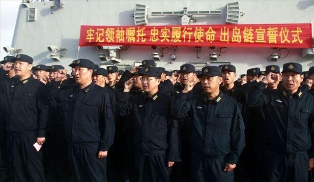
China’s People’s Liberation Army Navy (PLAN) forces took to the East China Sea in late June for live-fire maneuvers. These naval exercises were widely interpreted as expressions of preemptive Chinese displeasure over U.S.-South Korean exercises slated for the Yellow Sea. Washington dispatched the nuclear-powered aircraft carrier George Washington to Korean waters in late July as a gesture of solidarity with Seoul following the North Korean sinking of the South Korean corvette, Cheonan. The exercise, dubbed “Invincible Spirit,” thus was directed not at Beijing but at Pyongyang. Chinese leaders, however, ratcheted up their rhetoric while stepping up military activity in peripheral waters that China now explicitly defines as a “core interest.” Deterring U.S. Navy entry into the waters along the Asian seaboard has been a matter of utmost importance for military planners in Beijing since 1995 to 1996, when the United States sent two carrier groups to the vicinity of Taiwan to discourage Chinese military intervention in the island’s democratic election. In that conflict, the People’s Liberation Army (PLA) forces proved unable to detect, let alone threaten, U.S. Navy assets operating at China’s maritime door. Beijing vowed never again to let such an affront pass without responding. Tellingly, the U.S. leadership shifted Invincible Spirit to the Sea of Japan seemingly to placate Chinese sensibilities.
The recent posture adopted by the PLAN, however, underscores that there may be more to growing Chinese maritime activism than sending the United States a message. As China continues its ascent to great sea power, Chinese strategists increasingly view Asia’s complex maritime geography as a barrier to their nation’s rightful maritime ambitions. A glance at the map of the Western Pacific rim shows that PLAN formations cannot reach the Pacific high seas—whether to menace the east coast of Taiwan or for some other purpose—without passing through the islands that enclose the Chinese coastline. Japanese territories comprise the northern arc of this lengthy island chain. Geography, therefore, has situated two great seafaring nations in close quarters, leaving one astride the other’s access to the maritime commons. China cannot fulfill its maritime destiny without breaching this natural barrier.
Patterns of Chinese Naval Penetrations
After decades of hugging Chinese shorelines as a coastal-defense force, it only makes sense for the PLAN to practice the tactics, techniques and procedures needed to engage farther away from the Chinese seas in wartime. In light of Asia’s cramped maritime geography, it comes as little shock that Japan Maritime Self-Defense Force (JMSDF) units routinely discover PLAN units cruising near Japanese islands. As of this writing, PLAN warships have entered and exited the East China Sea through Japanese-held narrow seas on at least six occasions since 2004. Three incidents were particularly noteworthy.
Tsugaru Strait – In October 2008, a surface action group led by a Sovremennyy-class destroyer steamed through the Tsugaru Strait (marking the first time PLAN units had essayed such a transit), circumnavigated Japan, and circled back to port by way of the international strait between Okinawa and the Miyako Islands (Asia Times, April 22).
Okinotorishima – In June 2009, a Chinese flotilla centered on a Luzhou-class guided-missile destroyer—a vessel armed with an advanced air defense system—voyaged to waters near Okinotorishima through the same maritime gateway (Asia Times, April 22).
Miyako Strait – In April 2010, the JMSDF destroyers Choukai and Suzunami unexpectedly encountered eight PLAN warships and two submarines in international waters southwest of Okinawa, near the Ryukyus. The Chinese squadron transited the Miyako Strait—evidently Chinese commanders’ passage of choice—before turning south toward Okinotorishima. The Japanese government lodged a diplomatic protest with Beijing, to little avail [1].
Though modest in scale compared to U.S. naval operations, these expeditions demonstrate the PLAN’s capacity to operate east of the Japanese archipelago while testifying to its growing reach in the Western Pacific. Recent Sino-Japanese encounters offer a foretaste of East Asia’s nautical future.
Unsurprisingly, China’s naval activities sounded alarms within the defense community in Tokyo. In its annual white papers, Japan’s Ministry of Defense has reported with increasing granularity on the character of PLA operations in or near Japanese waters. The 2009 issue for the first time included charts depicting the courses taken by China’s flotillas. The graphics revealed the patterns of Chinese naval penetrations through the southern Ryukyu chain [2]. According to the National Institute for Defense Studies (NIDS), the Defense Ministry’s internal think-tank, “Given the noticeably greater amount of activity by Chinese naval vessels in the Pacific in recent years, it seems undeniable that China is envisaging operations between the so-called ‘first island chain’ (connecting the Ryukyu Islands, Taiwan and the Philippines) and the ‘second island chain’ (connecting the Bonin Islands and Guam)” [3]. The NIDS researchers are onto something. The Japanese archipelago constitutes not only the northern segment of the first island chain but also the northern terminus of the second island chain, which meanders southward from northern Japan to Papua New Guinea. As PLA forces start operating between the inner and outer island chains, consequently, it will be increasingly commonplace for them to pass through Japanese-held straits and passages and cruise along Japan’s eastern maritime frontier.
Japan and the Island Chains
Japan’s centrality to the island-chain construct, then, is difficult to overstate. Japan finds itself in a geo-strategic plight akin to 19th-century Cuba’s. Sea-power theorist Alfred Thayer Mahan declared that Cuba was so wide along its east-west axis that it formed a barrier between the Gulf of Mexico and the Caribbean Sea. This made it an outstanding base, even for a lesser navy. The weaker fleet could shift assets among numerous harbors overland while tapping the island’s abundant natural resources. It could defy a stronger fleet’s blockade. At the same time, however, geography positioned Cuba near a burgeoning, continent-spanning sea power that naturally took an interest in Cuban affairs. Then as now, this made for chronically tense relations between Cuba and the United States. This was especially true as engineers dug a canal across the Isthmus of Panama, beckoning American attention to the new sea-lane that was in the making in the Caribbean. Safe transit through the straits and passages connecting U.S. seaports with the Isthmus was critical for American merchantmen and warships bound for the Pacific [4].
Chinese Views of Japanese Islands
Some Chinese analysts strike a Mahanian note, depicting the Japanese islands as occupying the intersection between rival great powers’ maritime interests. As Zhang Songfeng of the PLA’s Institute of International Relations observes, “The maritime lifeline that Japan depends upon for its imports and exports is also the only passageway for China’s eastward entry into the Pacific, the United States’ westward entry into East Asia, and Russia’s southward movement” [5]. Others view the Japanese archipelago as home to the combined military power of the U.S.-Japan alliance, a strategic bloc that possesses the resolve and the capability to frustrate Chinese maritime ambitions. Writing in Modern Navy, a publication of the PLAN’s Political Department, Bai Yanlin asserts, “Along the northern line of the island chain closest to the Chinese mainland, the main military powers are the United States and Japan. As such, this area constitutes the very front line of the U.S.-Japan alliance’s containment of China” [6].
Geopolitically-minded commentators pay special attention to the Ryukyu Islands. Some fret that this crescent-shaped archipelago essentially closes off China from the Pacific Ocean. Three naval combat-systems engineers from the Marine Design and Research Institute describe Beijing’s maritime predicament in stark geopolitical terms [7]. Of the 16 major straits and channels critical to China’s oceanic access, they claim 11 are located along the Ryukyus, under Japanese control [8]. PLAN flotillas have passed through two of these narrow seas to date: (1) Miyako Strait, which separates Okinawa from Miyako, is 145 nautical miles (nm) wide and 500-1,500 meters deep; (2) Ishigaki Strait, which separates Miyako from Ishigaki, is 26 nm wide and 70-500 m deep [9]. Professor Shen Weilie of the PLA’s National Defense University views Okinawa as the “forward position” of the U.S. “westward strategy” in Asia [10]. He argues that cities such as Shanghai, Hangzhou and Xiamen are within striking distance from the island, while the Osumi and Miyako Straits could be monitored and blockaded from there.
Chinese strategists have been quite candid about the operational importance of this island perimeter to Japan during a cross-strait scenario. Aviation units forward deployed along the Ryukyu chain, contends Li Zhi, would play a critical part in contesting Chinese control of the air and sea [11]. As such, Chinese analysts carefully track the military disposition of the Self-Defense Forces along the Ryukyus. Every shift in posture, including minor deployments, is assessed under a microscope. For example, an announcement from the Japan Defense Ministry that a small army unit may be stationed on Yonaguni, an island only 110 kilometers from Taiwan, prompted Naval and Merchant Ships to dedicate a three-part feature to the strategic implications for China [12].
Gripped by anxieties about maritime encirclement, Chinese writers beseech Beijing to break out of the island chain. Some Chinese strategists maintain that the island chains are part of a U.S. strategy crafted after the Cold War to encircle China. For instance, Huang Yingxu of the China Academy of Military Sciences contends, “the U.S. assembled a C-shaped strategic formation” incorporating “the first and second island chains formed in the 1950’s.” This refers to the “defense perimeter of the Pacific” famously sketched by U.S. Secretary of State Dean Acheson in 1950. In Huang’s view, the United States has transposed its Cold War containment strategy to the post-Cold War era, inscribing a “C shaped encirclement, or encirclement arc” on the map of Eurasia. While this strategy “may not be entirely aimed at China,” he concludes, “it surely has the intention to curb and contain China” [13]. Beijing therefore must stymie this U.S. effort to shackle China’s great-power aspirations.
In a similar vein, a People’s Daily editorial proclaims, “For China … to make a breakthrough into the chain is also the first step for the Chinese Navy to achieve its blue dream, strengthen the defensive capability on the sea by gaining more maneuvering space and, hence, more effectively defend the security and integrity of territorial waters” (People’s Daily, April 22). Guo Yadong of the PLAN’s Naval Studies Institute defended the April 2010 transit of a ten-ship flotilla through the Ryukyus on more concrete military grounds. Rapid advances in precision-guided weaponry, the need to train realistically under complex meteorological and electromagnetic conditions, and the requirement to bolster logistics on the open ocean all demand access to the high seas. Consequently, exclaims Guo, “The first island chain has already become the bottleneck that the Chinese navy’s march to the deep blue must shatter” (Global Times, May 5).
Some analysts see the PLAN’s capacity to operate freely along the first island chain as a source of enormous leverage vis-à-vis Tokyo. Ni Lexiong, a professor at Shanghai University and an outspoken advocate of Chinese sea power, perceives the two nations’ mutual dependence on the sea lines of communication as a strategic opportunity for Beijing to secure a decisive advantage. This logic holds that China can hold Japan’s economic well-being at risk by constructing a first-rate navy. A pliant Tokyo may result. Explains Ni, “As we obtain absolute security of our own maritime lifeline, it also implies absolute control over Japan’s maritime lifeline” [14]. Zhan Huayun concurs, opining, “Japan has already oriented toward the strategic direction of China’s ‘three seas [Yellow, East China and South China Seas]’ in a desperate effort to expand its ‘survival space.’ If China possesses the capability to defend its national sea rights, then commanding the ‘three seas’ would mean control of Japan’s strategic lifeblood” [15].
Conclusion
To Chinese thinkers of neo-Mahanian leanings, then, naval power is a blunt instrument of statecraft that Beijing appears to be brandishing with increased frequency. Such strategists appear to attach vast importance to managing affairs along the Asian seaboard—particularly the Japanese archipelago—where they see that one of China’s chief rivals occupies important strategic features and has aligned itself with the preeminent sea power of the day to multiply its own naval strength. This demands PLAN operations of increasing vigor.
Yet strategy is a dynamic process. In effect, Tokyo has granted Beijing free rein to define and shape the Western Pacific since the Cold War, by declining to contest Chinese access to these waters. That may no longer remain true as the PLAN builds up its strength and asserts itself around the Japanese maritime periphery, and as American rule of Asian waters comes into question. Tightening up defenses along the Ryukyus and pursuing a modest naval buildup are obvious steps for Japan that Japanese leaders are undertaking. One hint at things to come: the Japanese press recently reportedly obtained a preview of the National Defense Program Guidelines slated for release at the end of 2010. The guidelines reportedly declare that the JMSDF will expand its submarine fleet from 18 to 20 boats (Sankei Shimbun, July 26; AFP, July 26). This marks the first such increase since the 1976 guidelines fixed the number at 18. It is reasonable to infer from this that the Japanese take the PLAN even more seriously than they did the Soviet Navy during its heyday. The next installment of this series on Japanese sea power, accordingly, will appraise the strategy and forces Tokyo is putting in place to cope with its resurgent seagoing neighbor.
Notes
1. “Chinese Navy’s New Strategy in Action,” IISS Strategic Comments 16, no. 16 (May 2010), International Institute for Strategic Studies Website, https://www.iiss.org/publications/strategic-comments/past-issues/volume-16-2010/may/chinese-navys-new-strategy-in-action/.
2. Japan Ministry of Defense, Defense of Japan 2009, July 2009, 56-57.
3. National Institute for Defense Studies, East Asian Strategic Review (Tokyo: NIDS, 2010), 127.
4. Alfred Thayer Mahan, The Interest of America in Sea Power, Present and Future (Boston: Little, Brown, 1897): 59-106, 271-314.
5. Zhang Songfeng, “Sino-Japanese Relations in the Process of China’s Peaceful Rise from a Geopolitical Viewpoint,” Modern Economic Information 23 (2009): 215.
6. Bai Yanlin, “The Unsinkable ‘Fleet’ — The First Island Chain and Navies,” Modern Navy 10 (2007): 12.
7. Declares the institute’s website, ““MARIC-Marine Design & Research Institute of China, founded in 1950, is the largest and comprehensive ship and offshore structure researching, developing, designing and engineering organization in China. MARIC is the mother company of Ship Design Technology National Engineering Research Center (SDT-ERC). MARIC is the backbone of the high tech R&D forces in merchant ship and marine industry.” MARIC Website, https://www.maric.com.cn/index_e.html.
8. Yu Kaijin, Li Guansuo, and Zao Yongheng, “Island Chain Analysis,” Ship and Boat 5 (October 2006): 14.
9. The next two widest straits are Tokashi Strait (23 nm wide, 400-600 m deep), between Kuchino, Yaku, and Kuchinoeraba; and Tokunominami Channel (18 nm wide, 350-600 m deep), between Tokuno and Okinoeraba. Presumably these also make attractive candidates for a PLAN breakout.
10. Shen Weilie, “Ryukyu, Island Chain, Great Power Strategy,” Lingdao Wencui 5 (2006): 63.
11. Li Zhi, “Japanese and South Korean Aviation Units: Application to Naval Operations and Influence on China,” Shipborne Weapons 12 (2007): 50.
12. See for example Gao Hui, “Japan’s Military Deployment at Yonaguni Island and China’s Maritime Security,” Naval and Merchant Ships 9 (2009): 26-29.
13. Huang Yingxu, “On the C Shaped Encirclement by the U.S.,” Study Times 154 (2010), https://www.studytimes.com.cn:9999/epaper/xxsb/html/2010/06/21/07/0m.
14. Ni Lexiong, “Highlighting China’s ‘Maritime Lifeline’ Problem,” Tongzhou Gongjin 11 (2009): 17.
15. Zhan Huayun, “The Influence and the Foreshadowing of the Maritime Security Environment on Strategy,” Modern Navy 8 (2007): 11.


