
Mapping Everything, Everywhere at Once: Examining New Advances in PLA Battlefield Reconnaissance Capabilities
Publication: China Brief Volume: 23 Issue: 11
By:

Introduction
Over the past decade, the People’s Liberation Army (PLA) has greatly improved its surveying and mapping (测绘) capabilities. This initiative has come at the behest of China’s Party-state leadership, which views access to high-quality topographical data as instrumental to “fighting and winning local wars under informatized conditions” (Geospatial World, January 31, 2011). [1] Consequently, the PLA has enriched the quality of its surveying and mapping systems by integrating information from civilian sources, developing new platforms for sharing battlefield reconnaissance intelligence and providing local commanders with increased access to geographic and navigational data. This mix of technical innovation and institutional reform portends the fruition of PLA efforts to become better tactically adept and more capable of undertaking complex missions such as joint operations.
The rationale behind China’s drive to enhance its military surveying and mapping capabilities can be gleaned from authoritative and semi-authoritative academic texts published by the PLA, which posit that access to accurate geospatial information is a lynchpin factor enabling modern joint operations. [2] For instance, books such as the Science of Campaigns (战役学) and Lectures on Joint Campaign Information Operations (联合战役信息作战教程) note that highly accurate knowledge of local terrain is crucial for enabling units to conduct complex maneuvers and direct effective long-range fires. [3] Moreover, operational guidance books such as the 2013 version of the Science of Military Strategy (战略学) assert that surveying and mapping data are core components of modern “informatized combat support systems” (信息化作战保障体系) that could be used to facilitate “operations against Taiwan and other overseas contingencies” (对台作战和海外军事行动). [4] Subsequent editions of the Science of Military Strategy further elaborate on this point, with both the 2017 and 2020 versions suggesting that military maps, remote sensing data, imagery and other battlefield environment intelligence resources should be integrated into a unified “joint combat information system” (网络信息体系的联合作战体系) in order to coordinate cross-domain wartime operations. [5] Both texts also feature sections calling for the construction of interoperable military-civilian infrastructure, under the aegis of military-civil fusion (军民融合), capable of sharing topographical, meteorological and navigational data. [6]
The increased importance that the PLA ascribes to surveying and mapping is reflected in its evolving organizational structure and mission set. Currently, responsibility for conducting surveying and mapping tasks lies with the PLA Strategic Support Force (SSF), which is the PLA’s main organ for gathering and distributing battlefield spatial intelligence. The SSF inherited these responsibilities from the former General Staff Department (GSD) Survey, Mapping and Navigation Bureau in 2016, as part of the broader set of reforms initiated under General Secretary Xi Jinping that aimed to streamline the PLA’s organizational structure (China Brief, May 19, 2019). As such, surveying and mapping units are grouped with other components of the PLA tasked with providing information assurance, including those which conduct electronic warfare and oversee PLA space-based assets such as its Beidou navigational satellite constellation. [7] This shift is not merely an exercise in organizational rebranding, but is rather reflective of an effort to both deepen and widen the scope of the PLASSF’s information support capabilities. The comprehensive nature of this approach is reflected in the term “battlefield environment support” (战场环境保障]), which is a phrase used by the PLA to describe the cross-cutting nature of modern surveying and mapping missions and encompasses a broad range of mission sets ranging from military navigation to oceanography. [8] The PLA has also expanded the range of surveying and mapping efforts beyond their traditional focus on supporting ground forces, with one PLASSF brigade commander noting that it holds the goal of “moving from primarily providing support for land-based operations to providing multi-dimensional and multi-domain support” (从陆上保障向多维空间保障转变) (China Military Online [CMO], July 15, 2020).
Charting the Battlespace
In order to fulfill its new battlefield environment support mission, the PLASSF has pursued two main lines of effort focusing on broadening the quantity of data that it collects, while also ensuring that commanders in the field can easily and reliably access those resources. This first line of effort has focused on remediating battlespace data “blind spots” for the PLA by mapping environs that were previously difficult to access such as “dense woodlands, deserts, and isolated islands” as well as areas along China’s periphery (CMO, December 9, 2020). In pursuing this undertaking, the PLASSF has benefited extensively from cooperation with civilian bureaucracies such as the Ministry of Natural Resources (MNR), which have aided in the construction of dual-purpose topographical databases. For instance, PLASSF military representatives routinely liaison with entities such as MNR’s National Satellite Ocean Application Center (国家卫星海洋应用中心) for the purpose of gathering marine remote sensing and geospatial data (National Satellite Ocean Application Service [NSOAS], no date; National Satellite Ocean Application Service [NSOAS] , February 24, 2020). The SSF’s research branches such as Information Engineering University (中国人民解放军战略支援部队信息工程大学) have also worked hand-in-glove with civilian institutions to draft several new regulations and technical standards aimed at controlling and upgrading the collection of surveying and mapping data (MNR, April 23, 2010). [9]. Crucially, these standards include provisions for improving the precision of geospatial information collected on overseas targets (Fig. 1), suggesting that China’s civilian space-based infrastructure is used to collect battlefield reconnaissance information to support PLA missions abroad.
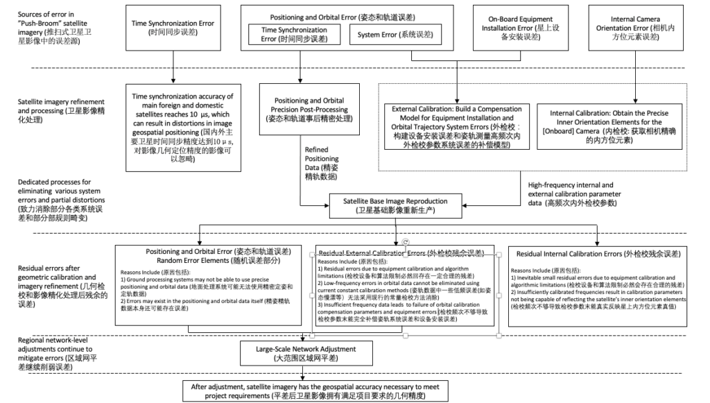
Figure 1: Excerpt from a draft standard published by MNR and co-developed by the SSF outlining procedures for gathering and refining accurate geospatial satellite information under “uncontrolled conditions” (无控条件) such as overseas environments not governed by the PRC. [12]
Concurrent to these collection efforts, the SSF has sought to build new platforms to integrate remote sensing and geospatial data. For instance, brigade components of the SSF have experimented with developing and adopting “mobile surveillance and mapping” (流动测绘) applications used for terrain modeling and operational planning (Ministry of National Defense, May 22, 2022; CMO, December 9, 2020). These so-called “electronic sand-table systems” (电子沙盘系统) improve upon earlier models by providing three dimensional simulations of rural and urban environments. These systems have the added advantage of being compatible with portable laptop computers, obviating the need to manufacture and distribute specialized hardware (Ministry of National Defense, May 22, 2022). The PLASSF has also taken steps to make accessing battlefield data more intuitive for field commanders. Accordingly, since 2019, units at all levels have access to a “Data Results Catalog” (数据成果目录) curated by the SSF (CMO, July 15, 2020). The Catalog enables officers at the brigade-level and above to request information support from a preconfigured “menu” (菜单) entering in a corresponding serial number in a task request form (CMO, July 15, 2020). Services offered by the Catalog range from provisioning artillery spotting and targeting data to unmanned aerial vehicle (UAV)-enabled surveillance and reconnaissance (CMO, January 4, 2021; CMO, July 15, 2020).
Enabling the Warfighter
The second line of effort undertaken by the SSF has focused on ensuring that battlefield commanders have timely and uninterrupted access to mapping and survey data. In order to accomplish this, the PLASSF has sought to transition its surveying and mapping staff away from being a primarily rear-echelon force towards more direct integration with front-line units. Consequently, recent PLA joint training exercises have begun to include small “Surveying and Mapping Emergency Support Elements” (测绘应急保障分队) embedded directly with forward deployed troops (CMO, January 4, 2021). These teams appear to consist of five PLASSF technical specialists who interface with commanders at the Army brigade (陆军某旅) level (CMO, May 10, 2022). These cohorts are responsible for maintaining the information systems used by the brigade, as well as ensuring the secure storage and transmission of the brigade’s data in “complex electromagnetic environments” (复杂电磁环境) (CMO, May 10, 2022). The benefits of this model are twofold. First, integrating SSF personnel as a local “battlefield [information] assurance force” (仗型保障力量) is regarded as being a key step in breaking down institutional stove-piping within the PLA and ensuring that commanders have complete access to a full range of data collected from multiple domains (CMO, January 4, 2021). Second, the presence of on-site PLASSF staff helps to ease difficulties inherent to providing long-distance technical support, which heretofore was a major factor preventing the PLA from operating effectively under adverse conditions (CMO, May 10, 2022).
The PLA is presently in the early stages of introducing the aforementioned reforms to its surveying and mapping capabilities, but appears intent on expediting their adoption across its entire organizational structure. For instance, though pilot Surveying and Mapping Emergency Support Elements were only first introduced in 2020, the PLASSF is currently seeking to rapidly diffuse that model among the PLA through frequent rotational and joint training (轮训+联训) exercises (CMO, May 10, 2022). These efforts have been supplemented by initiatives aimed at training brigade commanders across other services and branches on the use of tools developed by the PLASSF, such as its Data Results Catalog. The important priority given to this training is reflected in the high operational tempo of these training exercises. For instance, one PLASSF technical officer is quoted as having traveled to six different brigade-level units within a four day period in order to provide instruction on newly-developed battlefield reconnaissance tools (CMO, July 15, 2020). However, while the PLA appears sanguine as to the benefits that these reformed approaches to battlespace information support will provide, there is still acknowledgement among personnel that the development of these methods remain in a “teething period.” In particular, SSF personnel have noted that commanders from other services are often not fully aware of the new information support capabilities or how to access them (CMO, July 15, 2020). In order to remediate these issues, PLASSF is taking an iterative approach to cross-service training, with detachments regularly rotating through other units, collecting user feedback, and relaying those suggestions to decision-makers at headquarters (CMO, May 10, 2022).
Conclusion
The recent advances in the SSF’s surveying and mapping capabilities are a significant development with notable implications for future PLA behavior and capabilities. First, the SSF’s increased activity in peripheral areas such as littoral regions demonstrate an ambition to collect more granular information in environs such as the maritime domain where PLA geospatial intelligence has heretofore been lacking. Critically, it also signals an intent to conduct more robust operational preparation of the environment in contested areas such as the South China Sea. Moreover, the SSF’s growing reliance on dual-use infrastructure such as MNR geospatial assets to aid this mission further muddles the distinctions between Chinese military and civilian surveying activity. It is conceivable that this may result in future incidents such as that caused by the spy balloon overflight of the US in February (Straits Times, April 3).
Second, the creation of the PLASSF’s Data Operations Catalog is an important part of its overarching goal of constructing a “joint combat information system.” The fact that the SSF serves as the sole arbiter of this system also suggests that the PLA has made strides in rationalizing distribution of geospatial intelligence, with clearer procedures for requesting and provisioning information. While a full rollout of the Catalog appears to have been temporarily stymied by lack of familiarity with the new technology among the PLA officer corps, iterative joint training exercises would probably overcome these roadblocks. As a result, in the future PLA commanders at the brigade-level and above will enjoy access to a broadened range of cross-service information capabilities that is largely unencumbered by institutional stove-piping.
Finally, the SSF’s expanded role in providing battlefield reconnaissance data to other services marks an important step forward in its role as the PLA’s information support provider. In particular, the routine incorporation of the SSF into joint training exercises is a bellwether development, signaling that the PLA is making strides in putting its long-standing aspiration to conduct joint operations into full practice. Over time, regularized direct integration of SSF liaisons with components of the other services will deepen its institutional knowledge base for conducting integrated information support operations. This, in turn, will make the PLA more adept at undertaking operations that require close coordination of multiple services, such as a possible Taiwan contingency.
Notes
[1] Marcelyn L. Thompson, “PLA Observations of U.S. Contingency Planning: What Has it Learned” in The People’s Liberation Army and Contingency Planning in China (Washington D.C.: National Defense University Press, 2015) pp. 43-46.
[2] Within this context, “authoritative” sources refer to collectively-written capstone texts published by PLA military institutions such as the Academy of Military Sciences (中国人民解放军军事科学院). “Semi-authoritative” texts refer to those edited or written by individual named military academicians, but which nevertheless have been vetted and evaluated by committees of high-ranking PLA officers.
[3] Yuan Wenxian (袁文先) ed., Lectures on Joint Campaign Information Operations (联合战役信息作战教程), (Beijing: National Defense University Press, 2009), pp. 216-217; Zhang Yuliang (张玉良), ed., The Science of Campaigns [战役学] (Beijing: National Defense University Press, 2006), 228-230.
[4] Academy of Military Science Military Strategy Research Department (军事科学院军事战略研究部), The Science of Military Strategy (战略学) (Beijing: Military Sciences Press, 2013), pp. 261-266.
[5] Xiao Tianliang (肖天亮) et al., eds., The Science of Military Strategy (战略学) (Beijing: National Defense University Press, 2017), pp. 207-208, 341; Xiao Tianliang (肖天亮) et al., eds., The Science of Military Strategy (战略学) (Beijing: National Defense University Press, 2020), pg. 209.
[6] Xiao Tianliang (肖天亮) et al., eds., The Science of Military Strategy (战略学) (Beijing: National Defense University Press, 2017), pg. 341; Xiao Tianliang (肖天亮) et al., eds., The Science of Military Strategy (战略学) (Beijing: National Defense University Press, 2020), pp. 342-344.
[7] John, Costello and Joe McReynolds, “China’s Strategic Support Force: A Force for a New Era” in Chairman Xi Remakes the PLA: Assessing Chinese Military Reforms (Washington, D.C.: 2019, National Defense University Press), pp. 444
[8] Ibid. Pg. 477-478.
[9] Ministry of Natural Resources Ground Satellite Remote Sensing Application Center (自然资源部国土卫星遥感应用中心), “Global Geospatial Information Satellite Resource Remote Sensing Image Adjustment Technical Specifications” (全球地理信息资源卫星遥感影像区域网平差生产技术规范), (Beijing: Ministry of Natural Resources, 2022)


