
Satellites Support Growing PLA Maritime Monitoring and Targeting Capabilities
Publication: China Brief Volume: 11 Issue: 3
By:
New satellites are enhancing Chinese command, control, communications, computers, intelligence, surveillance, and reconnaissance (C4ISR) capabilities. These systems will enable the Chinese military to strengthen cueing, reconnaissance, communications, and data relay for maritime monitoring and targeting. The successful achievement of high quality real time satellite imagery, target-locating data and fusion, as well as reliable indigenous satellite navigation and positioning would facilitate holding enemy vessels at risk via devastating multi-axis strikes involving precision-guided ballistic and cruise missiles. Emerging space-based C4ISR capabilities could thus greatly increase China’s capability to use military means to assert its interests along its contested maritime periphery.
Beijing’s satellite capabilities, while still far from cutting-edge in many respects, are improving rapidly. China today has only a fraction of the overall space capability of the United States, retains major gaps in coverage in every satellite application, and relies to a considerable extent on technology acquired through non-military programs with foreign companies and governments. Beijing will likely purchase supplementary “high-resolution, electro-optical and synthetic aperture radar commercial imagery,” according to the U.S. Department of Defense (DoD), until it is able to deploy a more advanced set of reconnaissance satellites in the coming decade. The current sources of Chinese space imagery include “all of the major providers including Spot Image (Europe), Infoterra (Europe), MDA (Canada), Antrix (India), GeoEye (United States), and Digital Globe (United States)” [1].
Yet, Beijing is combining foreign knowledge with increasingly robust indigenous capabilities to produce significant advances in maritime C4ISR. High-resolution satellites, launchers, and launch infrastructure are prioritized. China is developing and acquiring relevant technologies via all available means, with satellite-specific “thermal insulation blankets” and “traveling wave tubes” cited by DoD as particular areas of foreign collection [2]. Chinese satellite developers are implementing a competitive workplace culture that emphasizes modern management, standardization, quality control (including ISO 9000 management initiatives) and emerging mass production ability—part of a larger trend in China’s dual-use military-technological projects [3]. China’s in-orbit assets are growing rapidly. Near/real-time C4ISR is facilitated increasingly by China’s integrated Qu Dian system and related networks and data links, which include secure People’s Liberation Army (PLA) voice/data communications provided by Fenghuo/Zhongxing/Shentong comsats [4].
Detection and Targeting from Space
These advances are greatly improving China’s ability to monitor and threaten force deployments on its periphery. According to VADM David Dorsett, Deputy Chief of Naval Operations (CNO) for Information Dominance, “Ten years ago if you looked at their C4ISR capabilities they did not have an over-the-horizon radar. They had virtually […] no ISR satellites. They now have a competent capability in ISR and over-the-horizon radars, but the years from now we expect a much greater increase in the numbers of satellites they have in orbit and their capability to fuse information” [5]. Specifically, DoD added that: “The PLA Navy is improving its over-the-horizon (OTH) targeting capability with Sky Wave and Surface Wave OTH radars. OTH radars could be used in conjunction with imagery satellites to assist in locating targets at great distances from PRC shores to support long range precision strikes, including by anti-ship ballistic missiles” (ASBM) [6]. A wide range of Chinese technical sources concur with the DoD’s assessment. According to two researchers affiliated with the PLA Navy Aviation Engineering Academy: “Through the integration of the data obtained via a number of different satellites, and with the addition of processing and data fusion, [one could] guarantee missile guidance requirements for all types of target information for a long-range ASBM strike” [7].
Satellites are already a key emerging link in ISR architecture that the PLA needs to detect, track, and—in a worst-case scenario—strike foreign surface vessels on its contested maritime periphery. China is developing a wide variety of precision weapons, including the initial operational capability-equivalent (IOC) DF-21D ASBM, which would benefit greatly from improved ISR capabilities. According to VADM Dorsett, while data fusion probably remains a challenge and China’s ASBM has yet to be tested against sea-based maneuvering targets, “China likely has the space based intelligence, surveillance and reconnaissance (ISR), command and control structure, and ground processing capabilities necessary to support DF-21D employment. China operates a wide spectrum of satellites, which can provide data useful for targeting within its maritime region.” Moreover, “China’s non-space based ISR could provide the necessary information to support DF-21D employment. This includes aircraft, UAVs, fishing boats, and over-the-horizon radar for ocean surveillance and targeting” [8]. This is significant, as many previous Chinese and foreign open source assessments claimed that the lack of satellite/C4ISR infrastructure precluded effective ASBM employment. Demonstrated Chinese ASBM capability to strike a moving maritime target would not only suggest the potency of a new, unique weapons system, but also serve as a bellwether of emerging C4ISR-supported anti-access/area denial (A2/AD) capabilities.
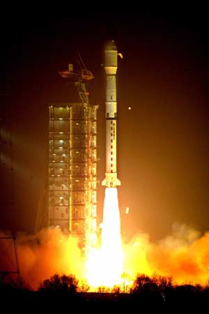
China’s ~15 reconnaissance-capable satellites include electro-optical, multi- and hyper-spectral, and radar, especially synthetic aperture radar (SAR). Several satellite series are particularly relevant to maritime monitoring.
Haiyang and Huanjing: Pioneering Ocean Surveillance
Maritime surveillance, a significant focus of PRC satellite development, has been prioritized at the national level as one of eight key areas specified by China’s 863 State High-Technology Development Plan [9]. China’s first series of dedicated maritime monitoring satellites is designed and developed by China Academy of Space Technology (CAST) and administered by the State Oceanic Administration (SOA).
China launched its first maritime observation satellite, Haiyang-1A, on 15 May 2002. This satellite, which monitored ocean water color and temperature, had military applications; an official publication states that 12 percent of Haiyang-1A’s 2003 “satellite data distribution” was “military.” HY-1B, with a 3X faster ocean color scanner (permitting a one day revisit period), was launched in April 2007 to survey China’s maritime periphery, including the East and South China seas. Fully operational versions are scheduled to follow: HY-1C, -1D, and -2A in 2011, and HY-3 in 2012 [10].
A total of 15 further Haiyang ocean monitoring satellites are planned, in three sets. The HY-1 series will monitor ocean color with an optical radiometer and sea surface temperature with a medium spatial resolution optical sensor. Eight satellites, designated HY-1C –J, will be launched in pairs every three years between 2011 and 2019. Four satellites, HY-2A –D, will be launched every three years over the same period. The HY-3 series will use synthetic aperture radar (SAR) sensors with 1-10 m resolution and X-band radar to monitor maritime resources, pollution, and coastal zones. Three satellites will be launched in 2012, 2017, and 2022 respectively.
Likewise relevant to maritime surveillance will be China’s Huanjing disaster/environmental monitoring constellation, envisioned to contain eleven satellites capable of visible, IR, multi-spectral, and SAR imaging. Two initial satellites in the series, Huanjing-1A and -1B, provide real time multi- and hyper-spectral imaging respectively, to a resolution of 30 m. Huanjing-1C and -1D are reportedly scheduled for launch in 2011. The full constellation is designed to form a complete image on China every 12 hours [11].
Yaogan: Opening Sharper Eyes for ISR
China’s Yaogan series of advanced SAR and electro-optical remote sensing satellites, while officially civilian in mission, operate from “similar, near-polar, Sun-synchronous orbits,” suggesting that they “provide multi-wavelength, overlapping, continuous medium resolution, global imagery of military targets” [12]. It may build on the Ziyuan/Jianbing series, China’s equivalent of the China-Brazil Earth Resources series, which conducts real time digital photoreconnaissance. It may also be related to the Tianhui-1 stereotopographic mapping satellite.
Yaogan 1, launched on 27 April 2006, has since completed its mission. Yaogan 2-11 were launched between 25 May 2007 and 22 September 2010, for a total of 12 satellites currently operational in orbit. The rapid pace of recent launches (7 since 9 December 2009) suggests that this is a particularly high priority for China. Yaogan 12 is reportedly scheduled for launch in March 2011; further launches could rapidly consolidate coverage of China’s maritime periphery. Table 1 details Yaogan satellites launched to date.
|
Satellite
|
Military Designation
|
NORAD ID
|
Int’l Code
|
Contractor
|
Launch Date
(UT)
|
Launch Site
|
Launch Vehicle
|
Orbit
(Perigree X Apogee km, inclination)
|
Type
|
|
Yaogan 1
|
JB-5-1
|
29092
|
2006-015A
|
SAST
|
2006.04.26
|
Taiyuan
|
CZ-4B
|
634 X 636, 97.9°
(since decayed)
|
SAR
|
|
Yaogan 2
|
JB-6-1
|
31490
|
2007-019A
|
CAST
|
2007.05.25
|
Jiuquan
|
CZ-2D
|
640 X 669, 97.9°
|
EO
|
|
Yaogan 3
|
JB-5-2
|
32289
|
2007-055A
|
SAST
|
2007.11.11
|
Taiyuan
|
CZ-4C
|
634 X 637, 97.8°
|
SAR
|
|
Yaogan 4
|
JB-6-2
|
33446
|
2008-061A
|
CAST
|
2008.12.01
|
Jiuquan
|
CZ-2D
|
643 X 666, 97.8°
|
EO
|
|
Yaogan 5
|
JB-8-1?
|
33456
|
2008-064A
|
CAST
|
2008.12.15
|
Taiyuan
|
CZ-4B
|
478 X 498, 97.3°
|
SAR
|
|
Yaogan 6
|
JB-7-1?
|
34839
|
2009-021A
|
SAST
|
2009.04.22
|
Taiyuan
|
CZ-2C
|
514 X 517, 97.6°
|
SAR
|
|
Yaogan 7
|
JB-6-3
|
36110
|
2009-069A
|
CAST
|
2009.12.09
|
Jiuquan
|
CZ-2D
|
635 X 674, 97.9°
|
EO
|
|
Yaogan 8
|
JB-7-2?
|
36121
|
2009-072A
|
SAST
|
2009.12.15
|
Taiyuan
|
CZ-4C
|
1200 X 1212, 100.4°
|
SAR
|
|
Yaogan 9 A/B/C
|
?
|
36413,
36414, 36415 |
2010-009A,
2010-009B, 2010-009C |
CAST
|
2010.03.05
|
Jiuquan
|
CZ-4C
|
1068 X 1127, 63.4°
|
ELINT
|
|
Yaogan 10
|
JB-5/7-3?
|
36834
|
2010-038A
|
SAST
|
2010.08.09
|
Taiyuan
|
CZ-4C
|
634 X 637, 97.8°
|
SAR
|
|
Yaogan 11
|
JB-6-4?
|
37165
|
2010-047A
|
CAST
|
2010.09.22
|
Jiuquan
|
CZ-2D
|
633 X 676, 98.0°
|
EO
|
Sources: “Real Time Satellite Tracking,” https://www.n2yo.com; “Yaogan (Jianbing 5/6/7),” www.sinodefence.com/space/military/yaogan.asp.
China uses a variety of other satellites to link these sensors to shooters, and support related network functions. Its first data relay satellite, Tianlian-1, facilitates near-real-time communication between satellites and ground control, complementing China’s > 10 ground stations and 4 operating Yuanwang space event support ships. Tianlian-2 will reportedly be launched in June 2011. To enhance weapons guidance accuracy, China’s Beidou-2/Compass navigation/positioning system will distribute positional data [15].
Compass: Providing Positioning and Communications
A central challenge for Chinese weapons employment is guaranteeing access to global positioning information without depending on the U.S. Global Positioning System (GPS) constellation, the signals of which Beijing fears the United States might restrict during wartime. A retired senior PLA official alleges that PLA analysis concluded that unexpected GPS disruption likely caused the PLA to lose track of the second and third missiles of a three-missile salvo being fired into the East China Sea 18.5 km from Taiwan’s Keelung naval port in March 1996, as part of a larger effort to deter what Beijing perceived to be pro-Taiwan independence moves. “It was a great shame for the PLA … an unforgettable humiliation. That’s how we made up our mind to develop our own global [satellite] navigation and positioning system, no matter how huge the cost. “Beidou is a must for us. We learned it the hard way.” Retired PLA general Xu Guangyu adds that China’s Beidou and Yuanwang systems guarantee that “There is no chance now for the US to use its GPS to interfere in our operations at all” [16].
Satellite navigation facilitates the monitoring of friendly forces and the targeting of enemy forces by offering reliable positioning signals. It supports command and control by providing basic communications functions. At present, China uses the U.S. GPS and Russia’s GLONASS satellite navigation systems as well as its own indigenous Beidou satellite navigation system [17]. Beijing has had only limited access to receiver technology and was denied access to the military mode of Europe’s nascent Galileo system, apparently intensifying existing Chinese efforts to develop Beidou further [18].
China deployed its own three-satellite Beidou-1 navigation constellation in 2007, but it is limited to providing service from 70 to 140 degrees east longitude and from 5 to 55 degrees north latitude and navigation coverage accurate to within ~20 m. This enables Beidou-1 to support operations on China’s immediate maritime periphery, but not further afield. To ensure reliable independent access in the future, and to support broader operations, China is deploying a 35-satellite (5 geostationary, 30 medium earth orbit) constellation—called Beidou-2/Compass—that would provide much-improved accuracy, with regional navigation and communications coverage anticipated by 2011 and global navigation and communications coverage by 2015-20 [19]. Seven satellites have been launched thus far; four remain fully operational. Table 2 details Beidou satellites launched to date.
Table 2: Beidou/Compass Satellites Launched to Date—Notional Specifications
|
Satellite
|
NORAD ID
|
Int’l Code
|
Contractor
|
Launch Date
(UT)
|
Launch Site
|
Launch Vehicle
|
Orbit
|
Status
|
|
Beidou-1A
|
26599
|
2000-069A
|
CAST/CASC
|
2000.10.30
|
Xichang
|
CZ-3A
|
GEO, 140°E 58.7°E (as of 2010.11.28)
|
Usefulness Uncertain
|
|
Beidou-1B
|
26643
|
2000-082A
|
CAST/CASC
|
2000.12.20
|
Xichang
|
CZ-3A
|
GEO 80.5°E
|
Operational
|
|
Beidou-1C
|
27813
|
2003-021A
|
CAST/CASC
|
2003.05.24
|
Xichang
|
CZ-3A
|
GEO 110.5°E
|
Operational
|
|
Beidou-1D
|
30323
|
2007-003A
|
CAST/CASC
|
2007.02.02
|
Xichang
|
CZ-3A
|
GEO 58.75° Disposal Obit (as of 2009.02.18)
|
Not Operational
|
|
Beidou–2/Compass–M1
|
31115
|
2007-011A
|
CAST/CASC
|
2007.04.13
|
Xichang
|
CZ-3A
|
MEO, period 1.289 hours
|
Experimental
|
|
Beidou-2B/
Compass-G2
|
34779
|
2009-018A
|
CAST/CASC
|
2009.04.14
|
Xichang
|
CZ-3C
|
GEO drifting; 84.5°E Librating ~ 75°E libration point (as of shortly after launch)
|
Not Operational
|
|
Beidou-2C/
Compass-G1
|
36287
|
2010-001A
|
CAST/CASC
|
2010.01.16
|
Xichang
|
CZ-3C
|
GEO 160.0°E 144.5°E (as of 2010.02.22)
|
Operational
|
|
Beidou-2D/
Compass-G3
|
36590
|
2010-024A
|
CAST/CASC
|
2010.06.02
|
Xichang
|
CZ-3C
|
GEO 84°E
|
Operational
|
|
Beidou-2/
Compass–IGSO-1
|
36828
|
2010-036A
|
CAST/CASC
|
2010.07.31
|
Xichang
|
CZ-3A
|
IGSO 118°E, 55.0°E incl.
|
Operational
|
|
Beidou-2E/
Compass-G4
|
37210
|
2010-057A
|
CAST/CASC
|
2010.10.31
|
Xichang
|
CZ-3C
|
GEO 160°E
|
Operational
|
|
Beidou-2/
Compass–IGSO-2
|
37256
|
2010-068A
|
CAST/CASC
|
2010.12.17
|
Xichang
|
CZ-3A
|
GEO
|
Operational
|
Sources: “Real Time Satellite Tracking,” https://www.n2yo.com; NASA, https://nssdc.gsfc.nasa.gov/nmc/SpacecraftQuery.jsp; www.gpsworld.com.
Conclusion
With China’s rapid progress in independent systems, or “hardware,” the biggest limitations on Chinese maritime surveillance and targeting lie in systems integration and “software.” As Admiral Dorsett states, “They don’t have a great ISR, integrated ISR capability. […] They don’t demonstrate a level of sophistication and joint warfighting. […] while they’re delivering technology and capabilities, they are at the early stages of operational proficiency across the board” [20]. Integration challenges involving software processing and data management and transfer reportedly plagued the PLA following Sichuan’s 2008 Wenchuan Earthquake, although its response to the 2010 Yushu Earthquake—which relied in part on satellites, e.g., Beijing 1—reflected significant “lessons learned.”
The sprawling, stovepiped nature of the many military services and organizations that control satellite/C4ISR architecture further complicates the horizontal/vertical inter-service, inter-level, military-civilian bureaucratic coordination necessary for real time data fusion to support kinetic operations. Institutional wrangling for control of China’s space assets continues among such organizations as the General Armaments Department, the General Staff Department, and PLA Air Force—and even the Second Artillery and PLA Navy to some extent. GAD controls all orbital satellite operations, yet lacks a combat role. The PLAAF has developed extensive space-related theoretical research and has an officially approved doctrine of “integrated air and space, using both offense and defense” [21], yet currently is not known to control any space assets. There are additionally rumors of a future Space Force [22]. Ownership and operational control of some satellites and applications are divided among more than a dozen governmental, university, and civil organizations, with 75 percent of satellites normally run by nonmilitary organizations and peacetime/wartime authority transfer dynamics remain unclear [23].
Despite these ongoing challenges, however, China’s surveillance satellites—together with the supporting infrastructure, human and otherwise—is improving rapidly. Beijing has a clear strategic rationale to master the relevant capabilities, particularly for A2/AD operations in its Near Seas (Yellow, East, and South) and their approaches. Doing so could finally enable the PLA to translate its traditional approach of achieving military superiority in a specific time and area even in a context of overall inferiority (yilie shengyou) into the maritime dimension.
Notes:
1. DoD, Military and Security Developments Involving the People’s Republic of China 2010, 36, https://www.defense.gov/pubs/pdfs/2010_CMPR_Final.pdf.
2. DoD (2010), 46.
3. “Hangtian Tsinghua Satellite Co. Approaches Satellite Market,” China Space News, May 28, 2004: 4.
4. “Feng Huo,” Jane’s Space Systems and Industry, May 5, 2010.
5. Defense Writers Group (DWG), Vice Admiral David J. Dorsett, Deputy CNO for Information Dominance (N2/N6), Transcript of Q&A, January 5, 2011, https://www.airforce-magazine.com/DWG/Documents/2011/January%202011/010511dorsett.pdf.
6. DoD (2010), 2.
7. Pan Changpeng et al., “An Analysis on the Capabilities of Military Satellites to Support Anti-Ship Missiles in Offense and Defense Operations,” Winged Missiles Journal, 5 (2006): 13. Op cit. Ian Easton and Mark Stokes, “China’s Electronic Intelligence (ELINT) Satellite Developments,” Project 2049 Institute, February 2011.
8. N2/N6 Public Affairs Office, January 3, 2011.
9. Mark Stokes, “China’s Evolving Conventional Strategic Strike Capability” (Arlington, VA: Project 2049 Institute, September 14, 2009), 14.
10. For all launch schedule predictions, see “Chinese Launch Record,”
https://www.sworld.com.au/steven/space/china-rec.txt; www.forum.nasaspaceflight.com.
11. “Satellites Will Help Predict Disasters,” China Daily, March 31, 2009, www.chinaview.cn.
12. “Yaogan Series,” Jane’s Space Systems and Industry, August 18, 2010.
13. Jane’s.
14. Su Jianwei et al., “Electronic Reconnaissance Effectiveness Analysis of Ocean Surveillance Satellite to Surface Ship,” Shipboard Electronic Countermeasures (August 2009): 51. Op. cit. Easton and Stokes.
15.”Beidou/Compass Series,” Jane’s Space Systems and Industry, August 18, 2010.
16. Minnie Chan, “‘Unforgettable Humiliation’ Led to Development of GPS Equivalent,” South China Morning Post, November 13, 2009,
https://www.asiafinest.com/forum/index.
php?showtopic=217363.
17. DoD (2010), 36.
18. Peter B. de Selding, “European Officials Poised to Remove Chinese Payloads From Galileo Sats,” 12 March 2010, https://www.spacenews.com/policy/100312-officials-poised-remove-chinese-payloads-galileo.html.
19. DoD (2010), 36.
20. DWG.
21. “China’s PLA Eyes Future in Space and Air: Air Force Commander,” People’s Daily Online, https://english.peopledaily.com.cn/90001/90776/90786/6799960.html.
22. For an apparent official Chinese denial of this possibility, see “China Grounds ‘Space Force’ Talk,” People’s Daily Online, November 6, 2009,
https://english.peopledaily.com.cn/6805305.html.
23. Eric Hagt and Matthew Durnin, “China’s Antiship Ballistic Missile: Developments and Missing Links,” Naval War College Review, Vol. 62, No. 4 (Autumn 2009): 87-115, A1-2.


